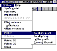
 GEOsurf-LT is a digital terrain model (DTM) application for AutoCAD LT (GEOsurf version for full AutoCAD is also available, incl. upgrade from LT-version and data compatibility).
GEOsurf-LT can import general X-Y-Z coordinate files from external sources or it can work on current 3D-drawing in AutoCAD-LT's graphic editor. Irregular triangular (TIN) 3D terrain model is computed from user-selected 3D control points and optional break-lines. Contours can be drawn in any selected altitude. Terrain profiles are generated in any pre-drawn path.
Typically: GEOsurf user imports his/her coordinate text file and optionally draws break-lines and profile paths. GEOsurf's terrain modeller then generates and optimizes 3D model based on user input and draws the resulting surface and contours to different layers in the current drawing. This drawing can be further edited by standard AutoCAD-LT commands.
Surface in GEOsurf-LT is represented by a series of 3DFACE entities, contours and profiles are made from POLYLINE entities. Generated 3D model is also suitable for visualization, rendering and computer animation (AutoVision, 3D Studio..).
GEOsurf-LT can be used as general DTM, not only for geodetical applications but generally for any physical model (thermical, light) or for surface modelling of precise mechanical parts, and for computing of isolines and profiles of these general models.
System requirements: