CAD Studio - CAD/CAM/GIS/BIM/PLM solutions


")
 GeoRefImg - georeferencing raster images in AutoCAD
![]() GeoRefImg is a LISP utility for AutoCAD 2004, 2005, 2006,
2007, 2008, 2009, 2010, 2011, 2012, 2013, 2014, 2015, 2016, 2017, 2018, 2019, 2020, 2021, 2022, 2023, 2024, 2025, 2026 (plus Architecture, Mechanical,
MEP) which can automatically reposition raster images used in
a drawing to the position defined in the images' World files.
World files define geo-position and other parameters of a
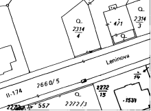
raster image (TIF, CIT, JPG, JP2, PNG, GIF, BMP, ECW, SID...).
GeoRefImg is a LISP utility for AutoCAD 2004, 2005, 2006,
2007, 2008, 2009, 2010, 2011, 2012, 2013, 2014, 2015, 2016, 2017, 2018, 2019, 2020, 2021, 2022, 2023, 2024, 2025, 2026 (plus Architecture, Mechanical,
MEP) which can automatically reposition raster images used in
a drawing to the position defined in the images' World files.
World files define geo-position and other parameters of a
raster image (TIF, CIT, JPG, JP2, PNG, GIF, BMP, ECW, SID...).
Besides the Windows version, there is also a GeoRefImgMac.fas file for AutoCAD for Mac (in the distribution ZIP).
Load this utility with _APPLOAD.
For AutoCAD 2012/2013/2014...: automatically install GeoRefImg from Apps Exchange, or copy the whole "GeoRefImg.bundle" folder as a subfolder to:
C:\Program Files\Autodesk\ApplicationPluginsor (XP):
C:\Documents and Settings\<usrname>\Application Data\Autodesk\ApplicationPluginsor (Win11/Win10/Win8/Win7/Vista):
C:\Users\<usrname>\AppData\Roaming\Autodesk\ApplicationPlugins-- GeoRefImg will be loaded automatically (see _APPAUTOLOADER)
Start GeoRefImg by typing the GEOREFIMG command. GeoRefImg prompts to select objects (existing images) and then performs the repositioning and scaling controlled by the World files (TFW, TFWx, JGW, JPW, JGWx, PGW, GFW, BPW, SDW, EWW, WLD...). World files are searched in the folders of the original raster file. So you always need two files - the image and the world file. Use full paths for images (REFPATHTYPE=2).
The additional command WORLDOUT can create a new world file from an existing positioned image. Rotated images are supported since version 2.5.
The additional command IMAGESATTACH can attach multiple images at once (one below one). Available since version 3.1.
Since V3.2 you can use the AGRI command (toggle) to enable a reactor which will try to georeference images automatically right after you attach them using a standard AutoCAD command. You can preset the autoreference mode ON with:
(setq _georefimg_agri T)
Since V3.4 the current Auto-ref mode is displayed in AutoCAD status bar (if no other modemacro mode is active).
GEOREFIMG checks the format of the world file and refuses to update images with "suspect" world files. You can control the tolerance (precision) and some of the pre-flight checks:
(setq GeoRefCheckTol 0.03)
(setq GeoRefCheckIgnore T)
GeoRefImg communicates in English, Czech or Hungarian (auto-switched).
Related tips:
NB:
* Rotation defined in the world file (rarely used) is
applied only since GeoRefImg version 1.5
* GeoRefImg does not handle georeference information embedded directly in raster files (e.g. GeoTiff, some ECW files).
* GeoRefImg is useful even in AutoCAD Map and Civil3D
(already contain georeferencing) as WorldOut works there.
GEOREFIMG is a free utility by CAD Studio (ARKANCE), do not publish it online on other than CADstudio's web servers. Contact CAD Studio for feature enhancements.

 Download the free GeoRefImg application (for AutoCAD 2026-2004)


